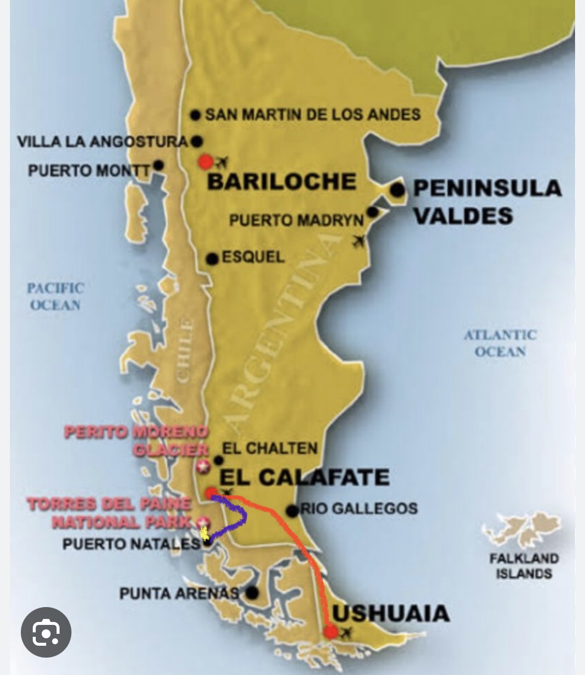
What you’re looking at here is a very basic map of Patagonia. The boat I was on for my trip to Antarctica got back to Ushuaia in southern Argentina on the morning of Sunday, January 14. That afternoon, I took a flight on Aerolíneas Argentinas from Ushuaia up to El Calafate (indicated by the red line on the map) where I spent the night. The next day, (shown in purple) I took a bus from El Calafate, Argentina, across the border to Puerto Natales, Chile. I spent two nights there in Natales because I wanted to get some laundry done and because I just kinda wanted to sit on my ass doing nothing for a day. So after that, on the morning of the 17th, I took a bus (shown in yellow) from Puerto Natales a couple hours north to Torres del Paine national park where I’d right away get going on an 8-day hike called the “O Circuit.”
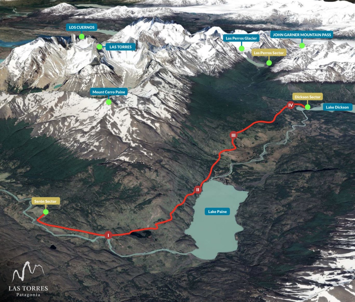
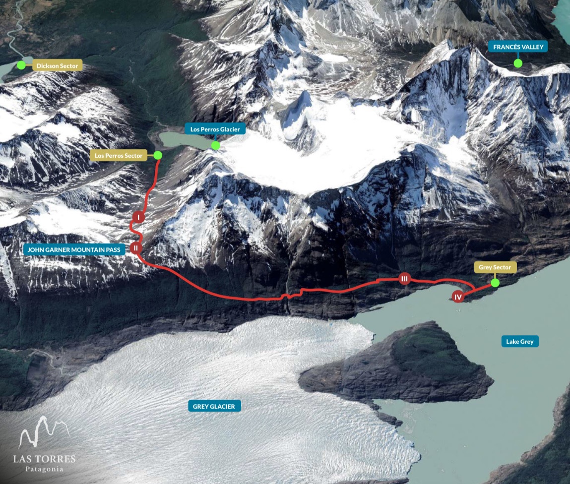
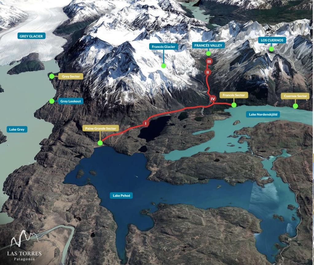
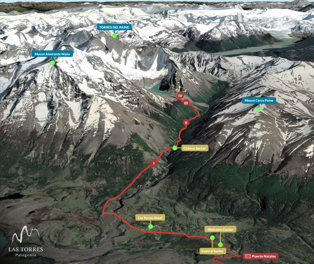
Here is a map of the O Circuit in Torres del Paine national park. I walked it counter-clockwise. The welcome center where I got dropped off at is right near Central Sector down on the bottom right part of the red circle, and the yellow number 1 that I scribbled there indicates the route that I walked over to the camp known as Serón on the first day. Like that, following the numbers, you can see which stretch of the route I walked on each of the eight days. Whereas it is possible to book your spots in each of these campsites on your own, because different campsites are owned by different companies that got their own websites, I kinda found the process to be a major pain in the ass and decided to hire the company Las Torres Patagonia (the ones who provided me with this and all other maps I’ll be using on this post) to make the reservations for me. Because this is a very popular route and I’d read somewhere that there’s a maximum limit of 70 people doing the O Circuit per day, I made said reservations about five months ahead of time. In addition to a tent, sleeping bag and sleeping mat that’d be waiting for me each night, my reservations included breakfast and dinner at each of the campsites as well as a box lunch to take with me and eat while I’m out hiking.
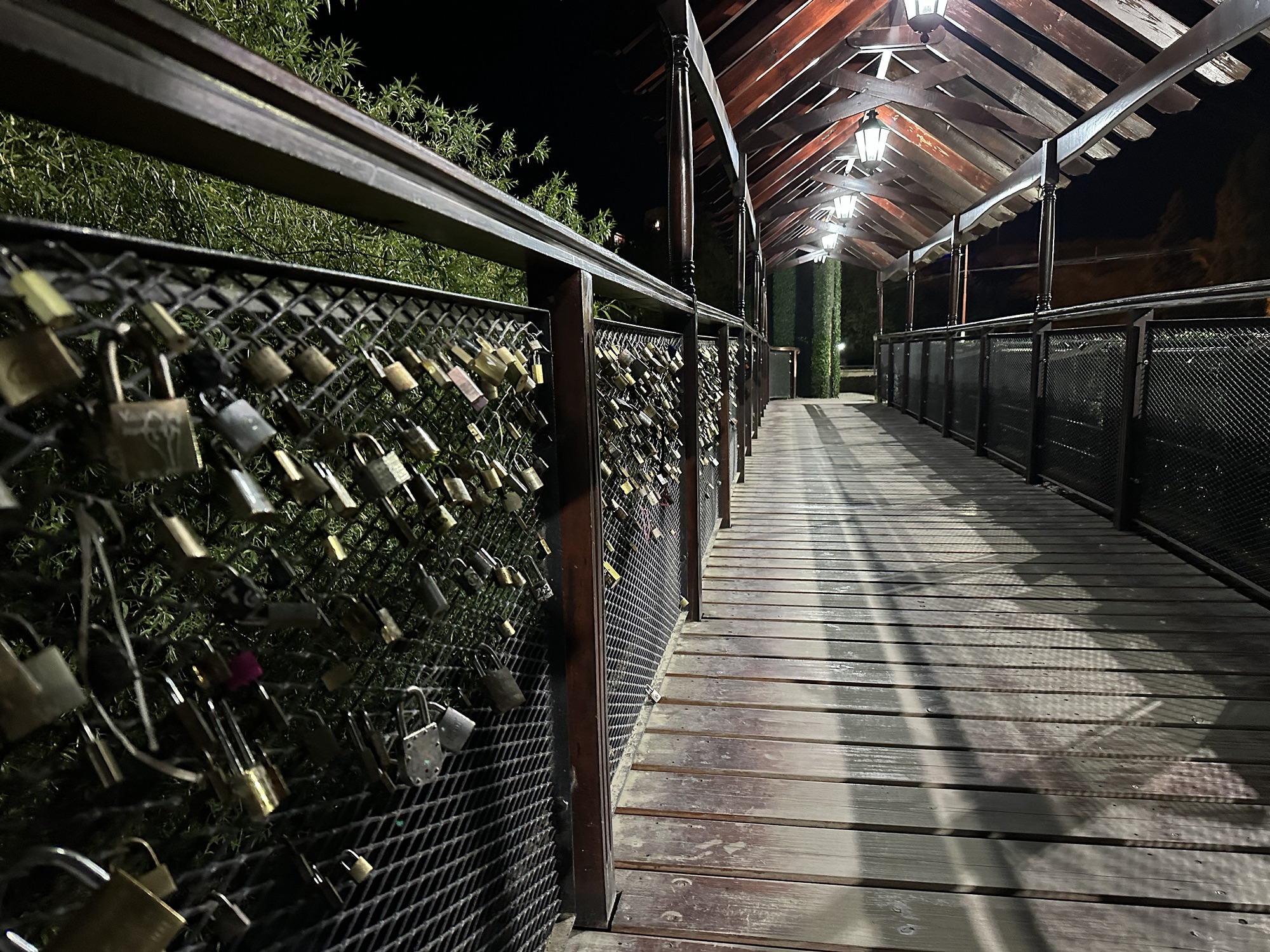
“Love locks” on a bridge in El Calafate. Apparently couples put these things up then throw away the key as a way to symbolize the everlasting love they have for one another
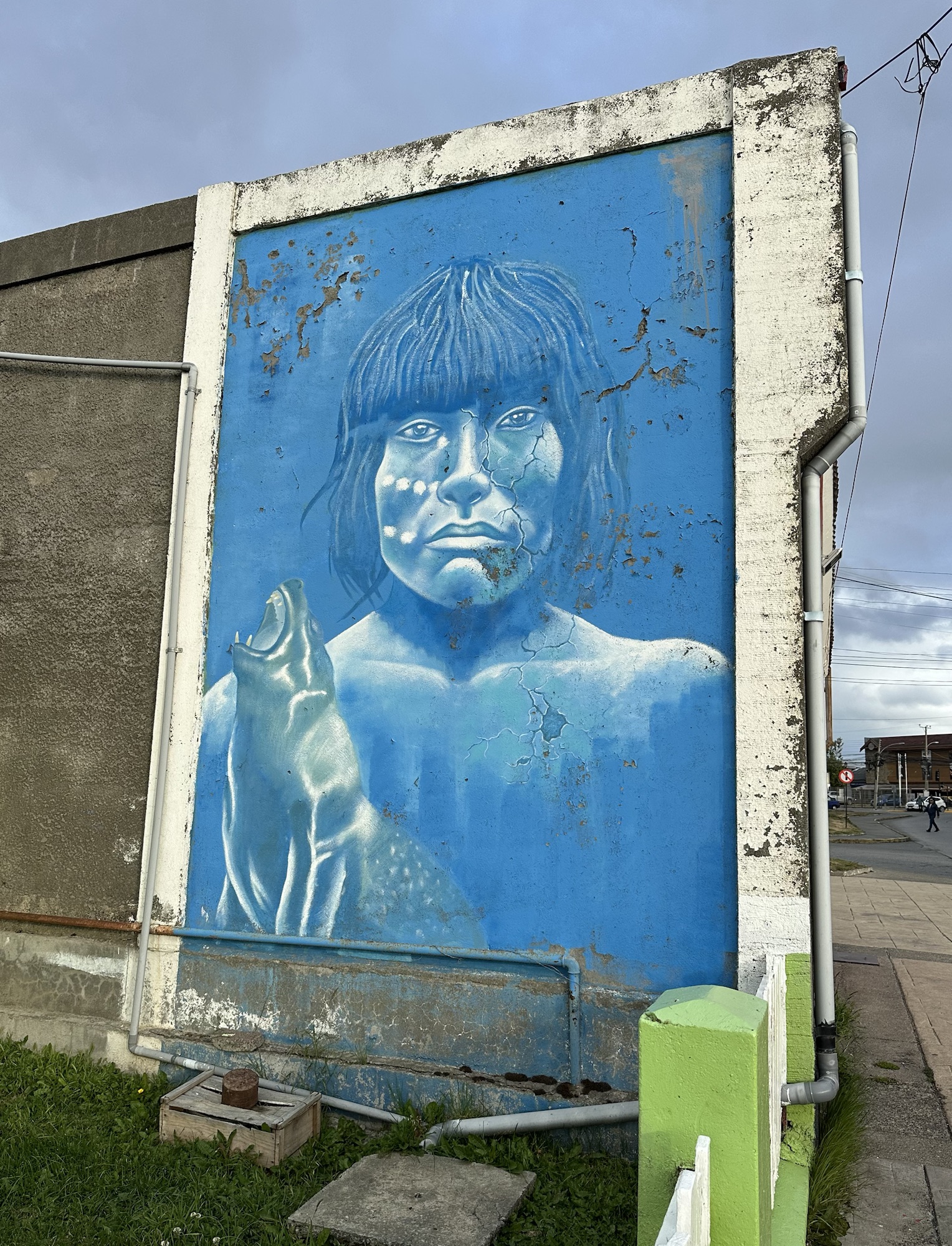
One of many murals around Puerto Natales dedicated to the indigenous people of Patagonia. Not too many of those guys left around these parts.
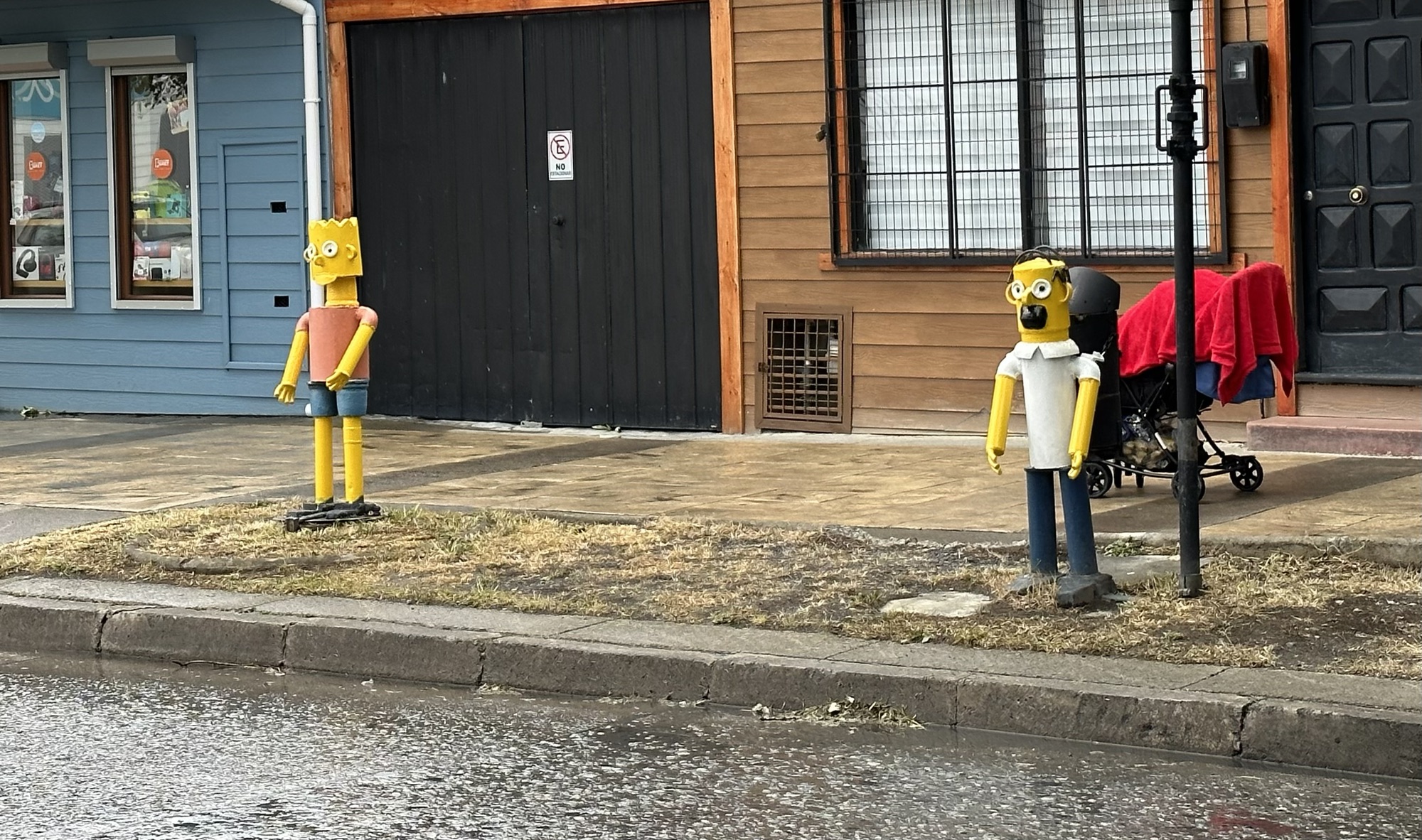
Los Simpson. Homero with a garbage can strapped to his back and tin can Bart just kickin it
Some graffiti just outside my Airbnb in Puerto Natales that says “Masturbate your mind, ejaculate ideas”
Day 1: Centro de Bienvenida to Serón
The bus from Puerto Natales takes you to this place called Laguna Amarga which was like the formal entrance to the national park. There, some rangers told us the rules of what you can and can’t do in Torres del Paine. From Laguna Amarga, I took a 10-minute shuttle bus over to the Centro de Bienvenida, which in English means Welcome Center. It was there I signed my name into some notebook and then was handed a bag with a complimentary sleeping bag liner, a pack towel and a small reusable water bottle. I then grabbed my box lunch from a separate building behind the welcome center and was on my way to Serón.
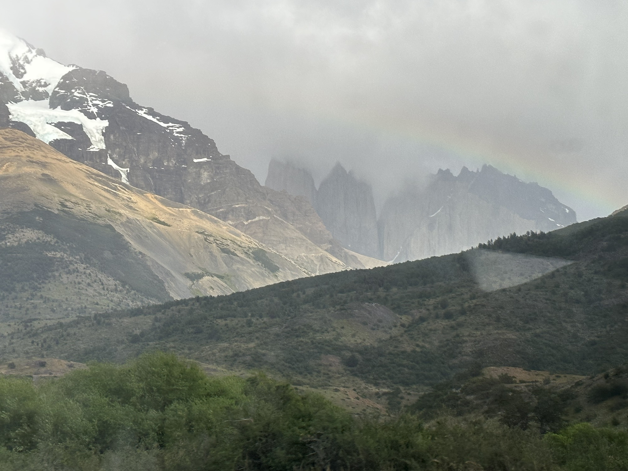
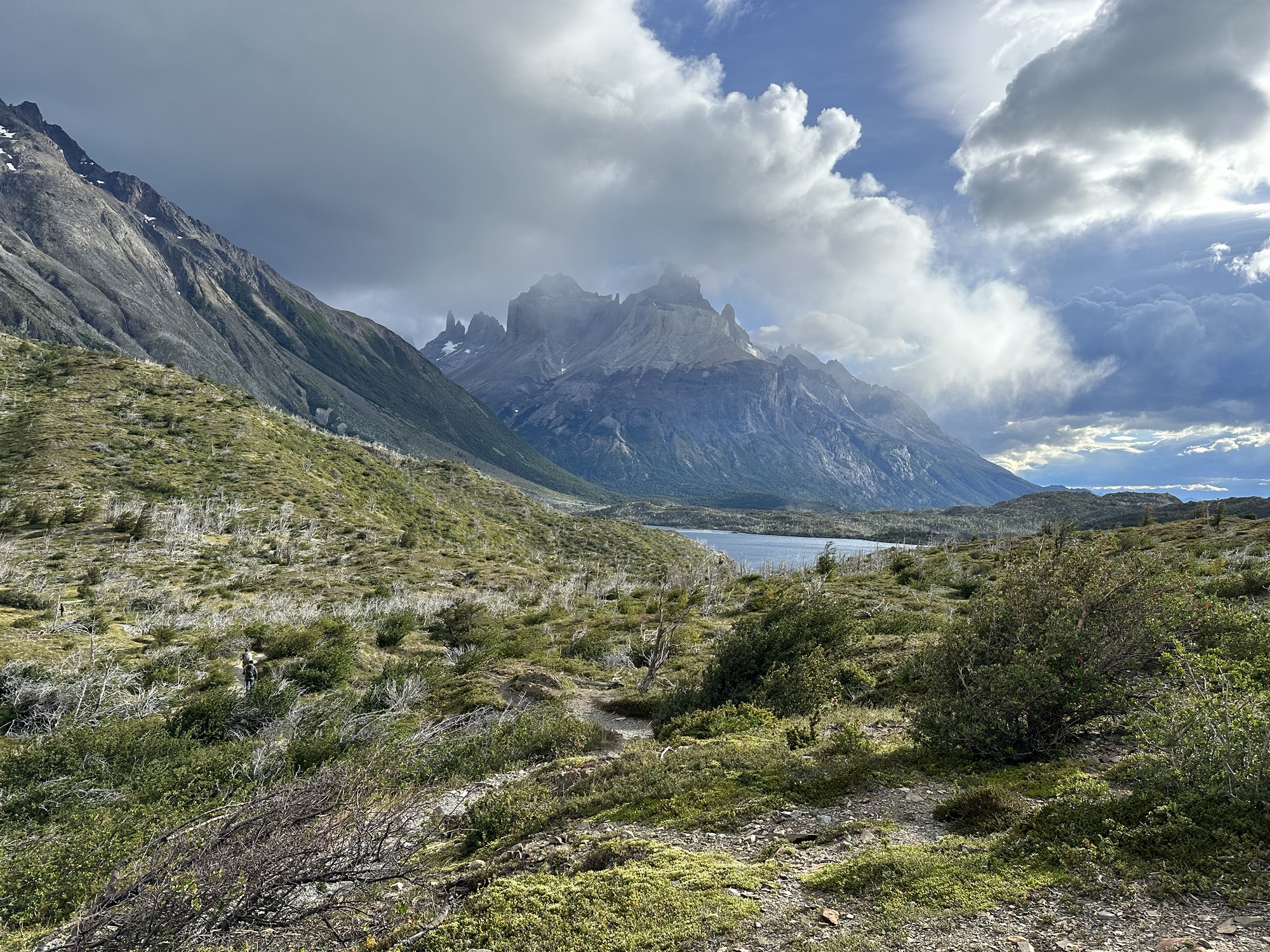
Although I wouldn’t be climbing up to the iconic Torres del Paine until the eighth and final day of the O Circuit hike, this view of the route up towards the “towers” with the rainbow streaking across the sky was the first image I remember from being in the park.
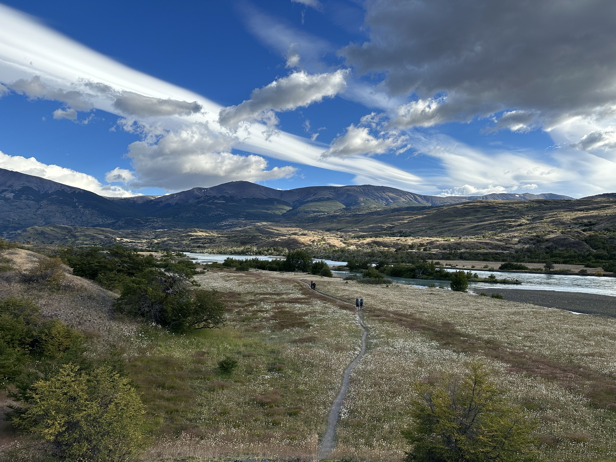
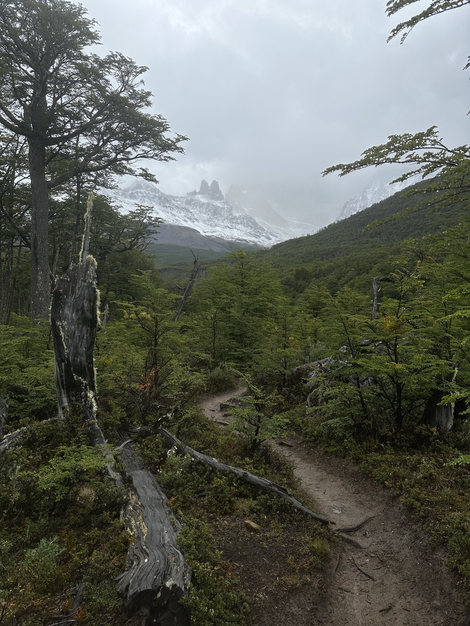
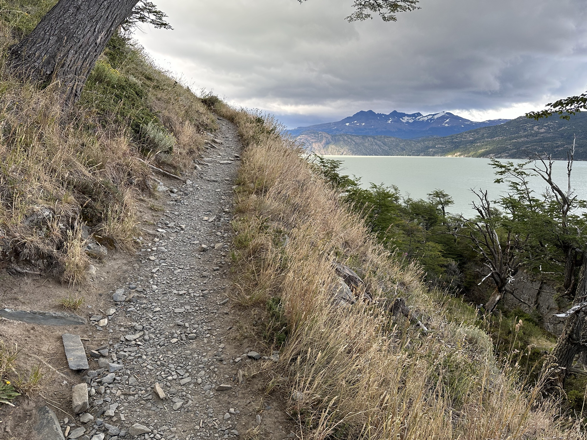
The route to Serón was nice and easy. There wasn’t much elevation gain or loss and the path was pretty clear, without any big rocks or crazy tree roots that you could trip or sprain your ankle on
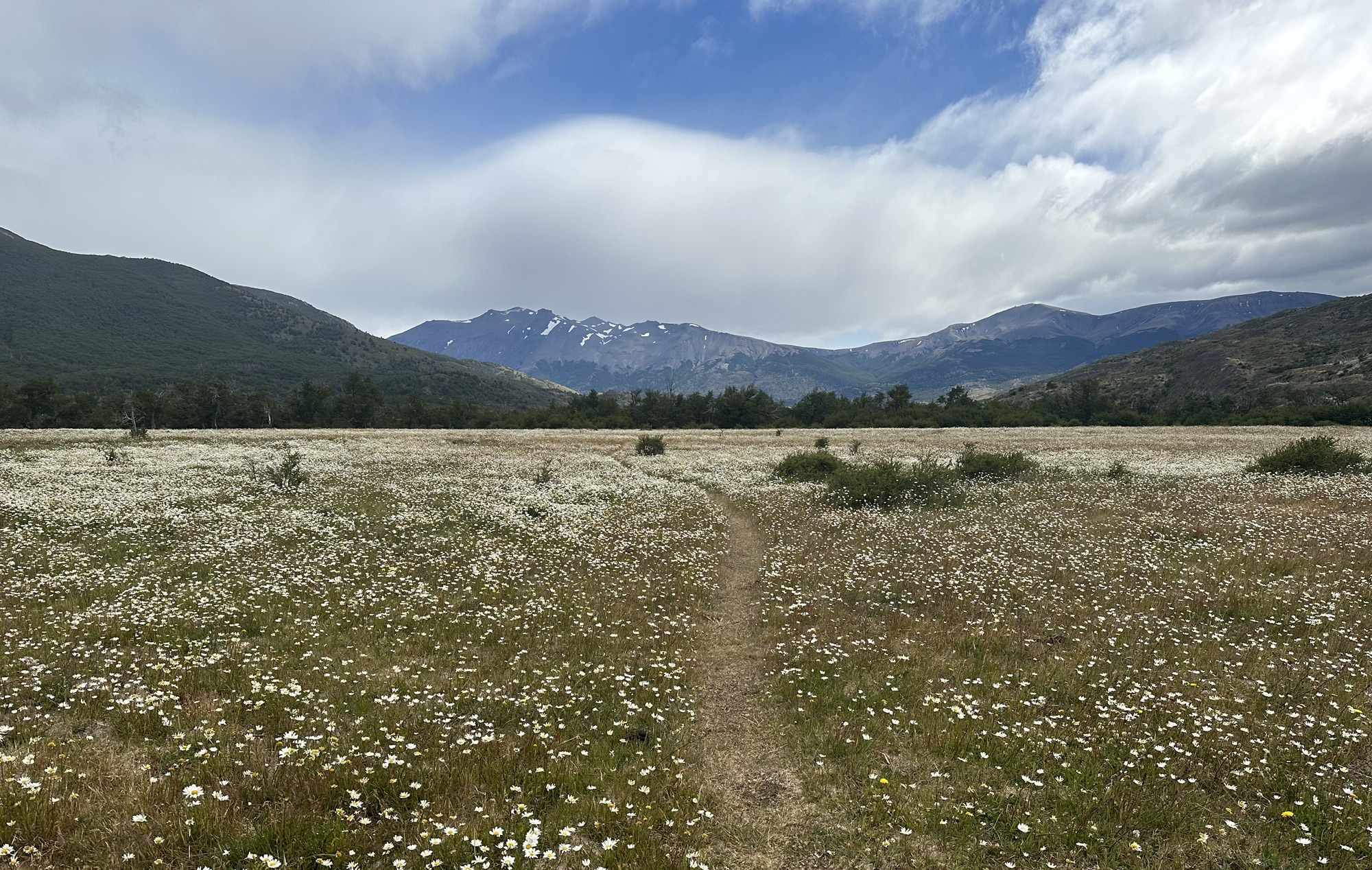
Flowers everywheeeeeeeeerrrrrre (I love the flower girl) Oh I don’t know just why, she simply caught my eye (I love the flower girl) She seemed so sweet and kind, she crept into my mind
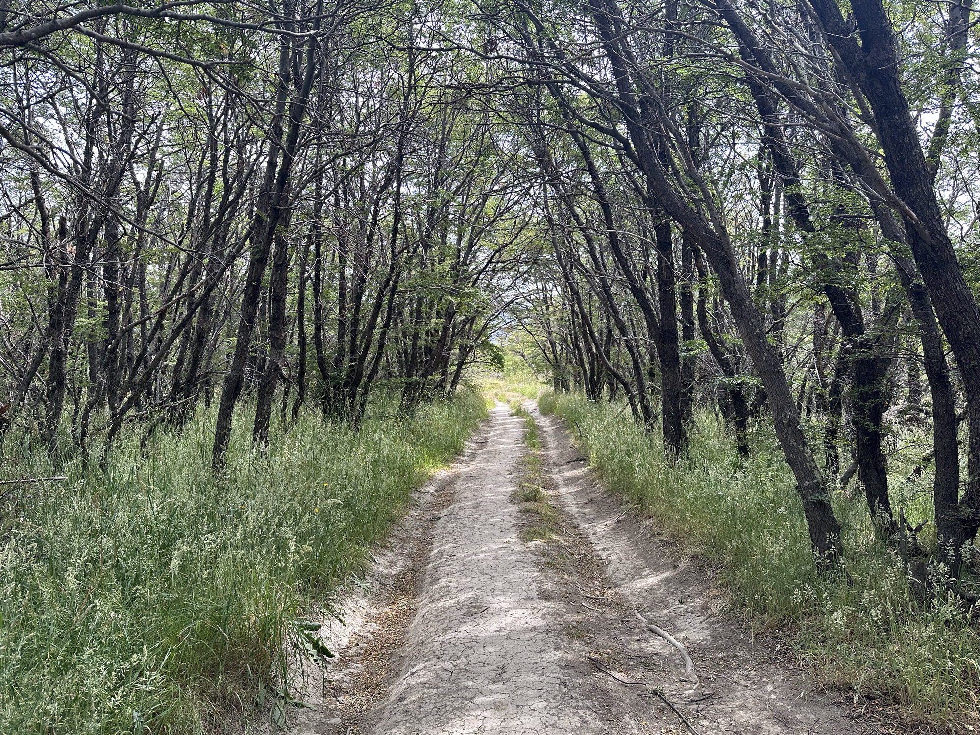
Backwoods
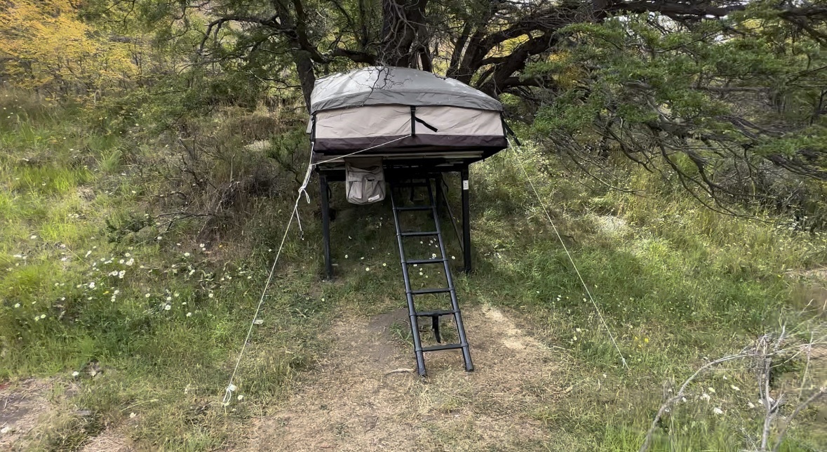
I’d probably started walking around 9am and the walk to Serón only took like three hours, so I got there around noon. And at Serón, even though the people running that campsite were just sitting around and didn’t seem like they had anything better to do, they wouldn’t allow anyone to check in until 2:30pm, and by the time 2:30 rolled around there were 70 people waiting to check in. Even though I was one of the first ones there, I wasn’t super aggressive about getting a good place in line when they started checking people in, so I ended up being one of the last people served and didn’t get a tent until around 4:30. This was a very annoying first impression of how things are run at the campsites in the park, but thankfully at all the other camps – even if you got there before the listed check-in time – they’d get you settled in right away so you can unpack your bag and shower and do whatever you wanna do to relax before dinnertime. That said, this is the tent I was assigned at Serón. I never stayed in one of these things before.
Inside of the tent. Pretty nice, though not the easiest to climb down and out of when you gotta take a piss in the middle of the night
The food at all the campsites was pretty good. The dinner at Serón was salmon with hollandaise sauce served over rice
Day 2: Serón to Dickson
18 kilometers from Serón to Dickson (in Spanish, Camp Dickson is referred to as Campamento Hijo de Verga)
Cool sky
As I came up to the top of this pass with this view of Lake Paine down on the other side, the wind was so strong that it was ripping my phone out of my hand and had been opening my mouth involuntarily and flapping my cheeks around the way that happens to dogs when they stick their heads out the car window while driving on the highway.
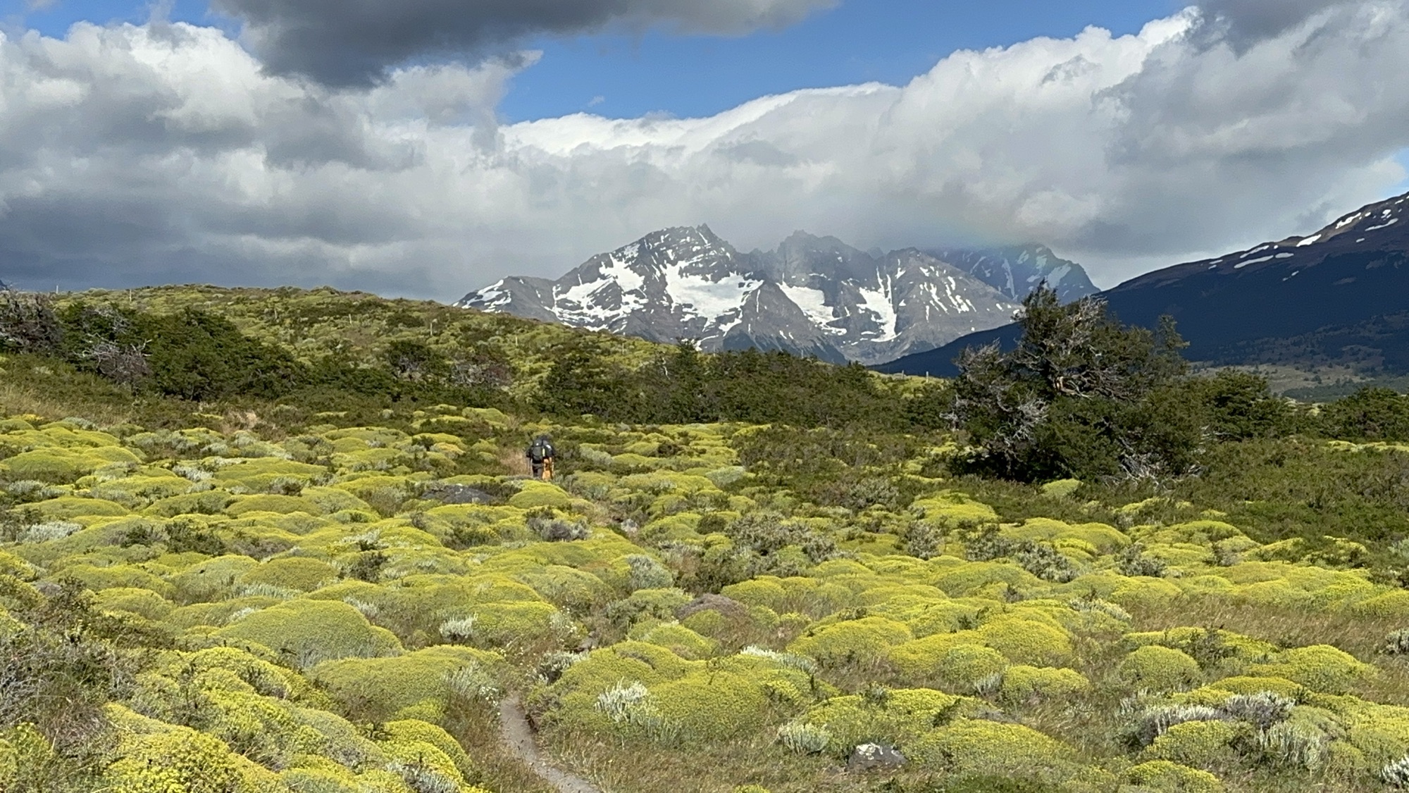
Couple hikers ahead of me there just to the left of the photo’s center. I think this type of terrain is called Pre-Andean scrubland. Whatever it is, I enjoyed the colors of it.
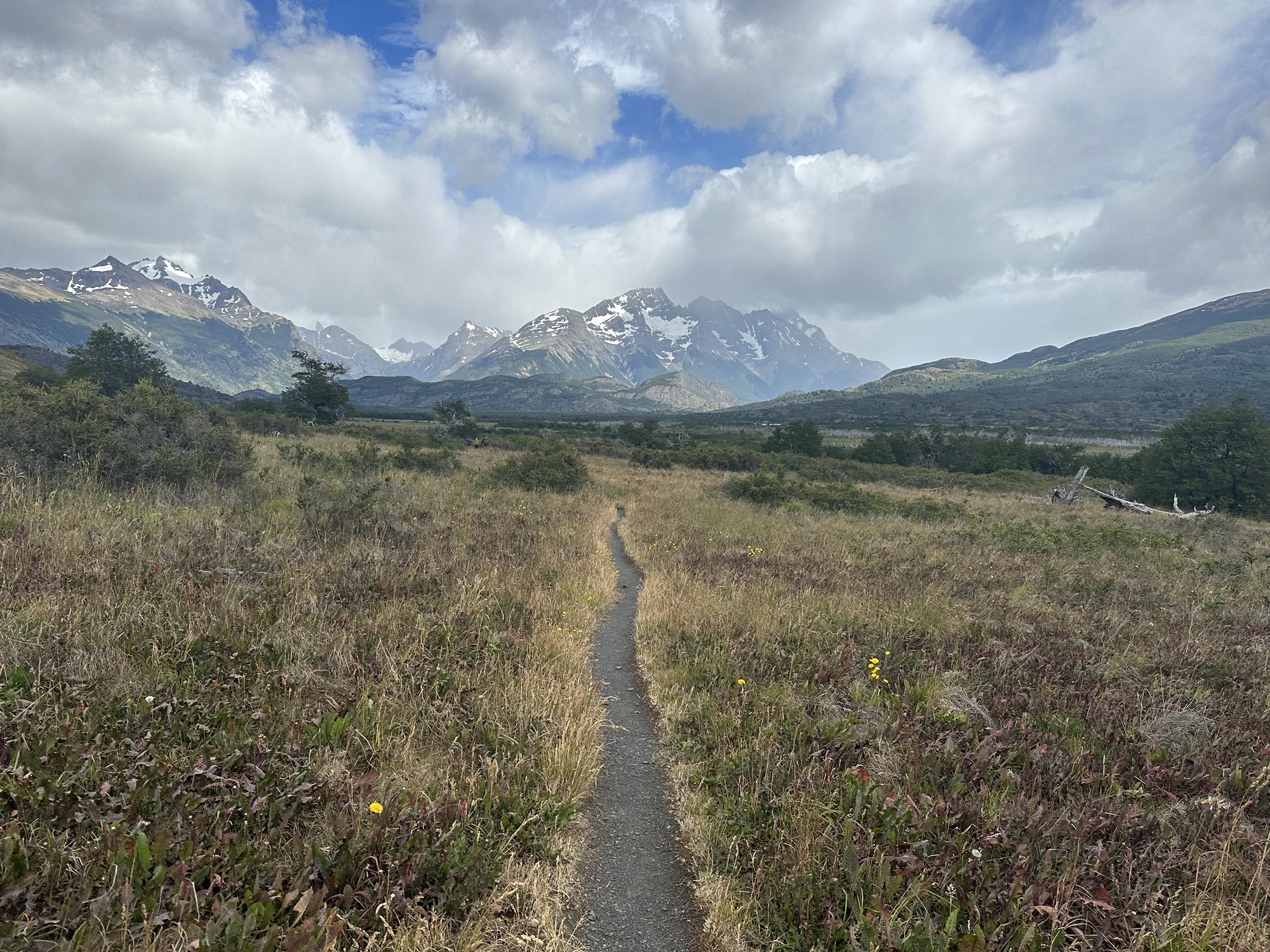
Stay on track
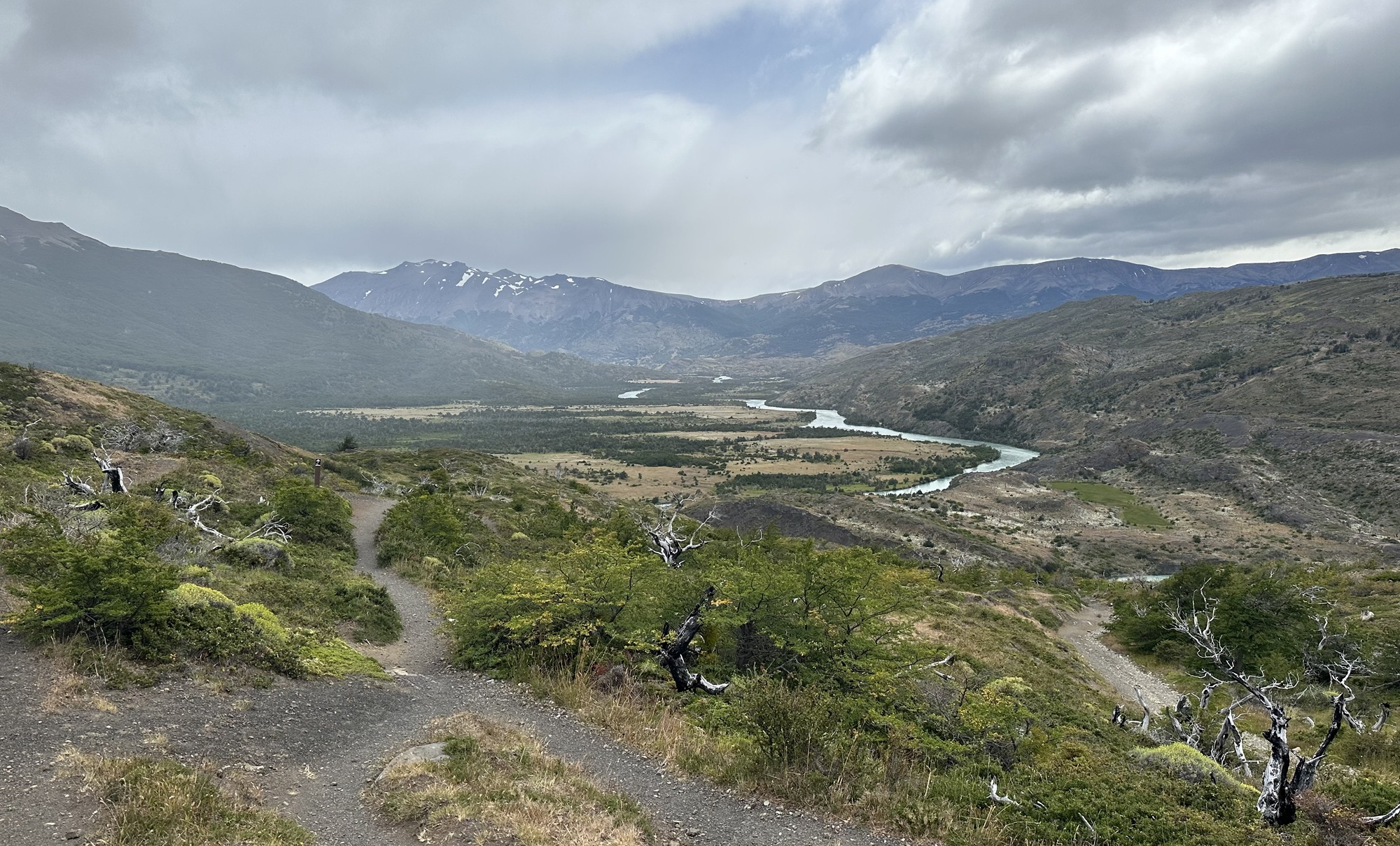
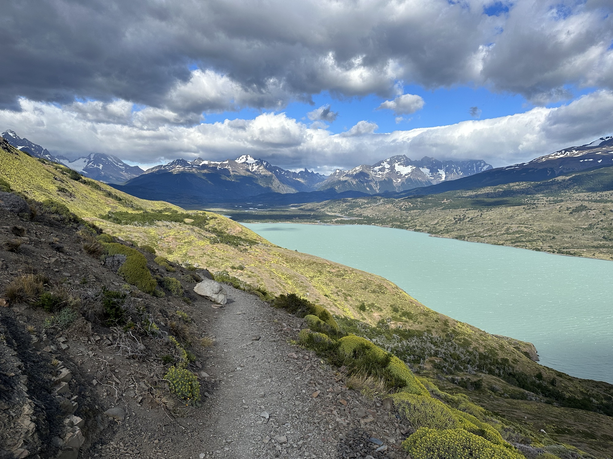
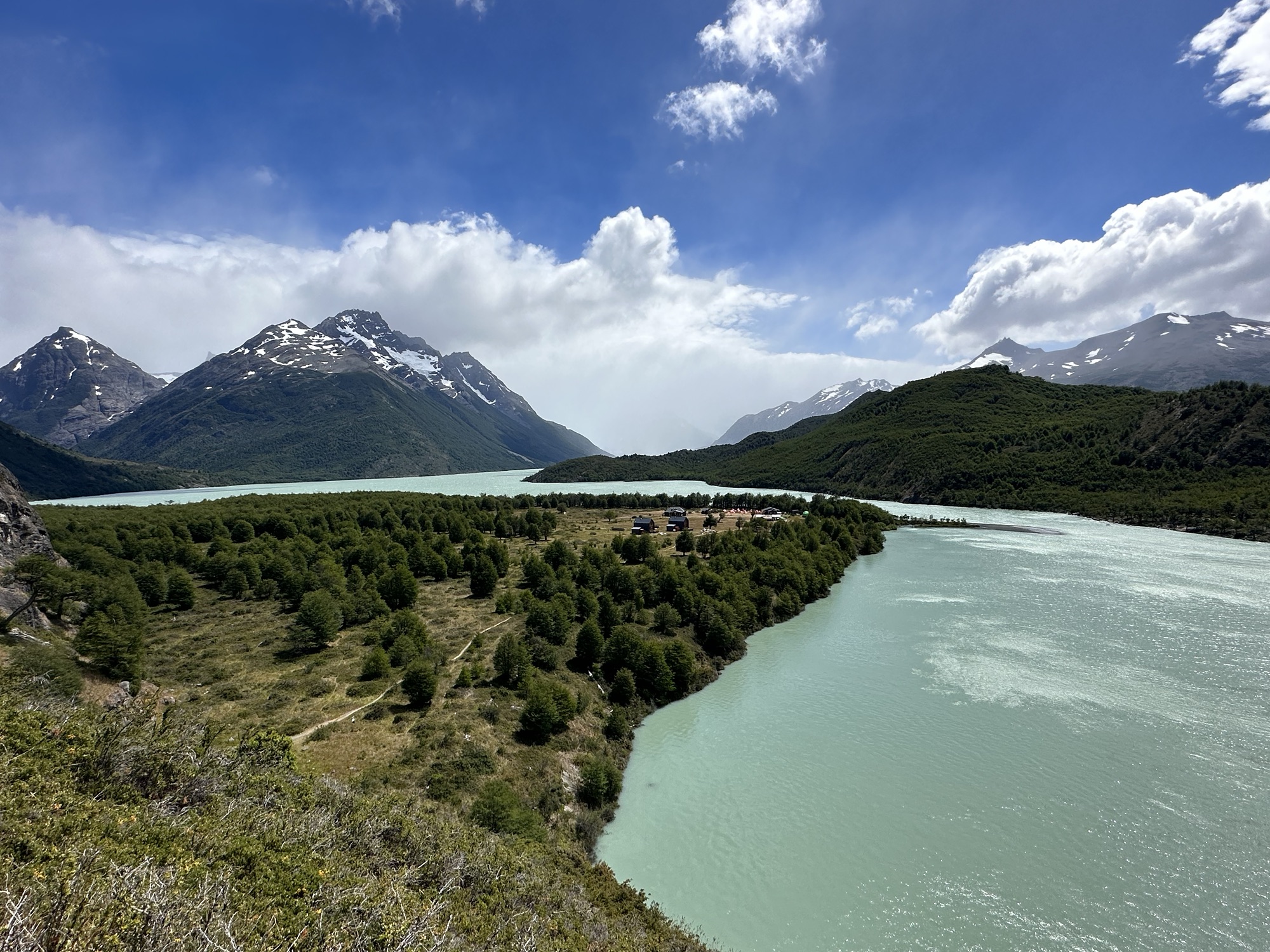
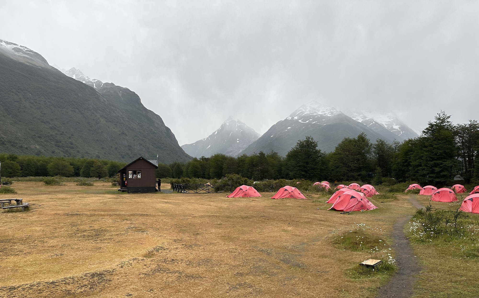
Down there in the middle of the land jutting out into Lake Dickson is the camp where I’d be spending the night
Day 3: Dickson to Los Perros
Easy day. Only 9km between Dickson and Los Perros
Unlike the elevated tents offered in Serón, the ones at Dickson had just been normal tents on the ground. Although the thought of using the same tents and sleeping bags that other gross, sweaty hikers have been using every night for the whole season is kind of disgusting, I still preferred it over carrying all my own equipment. And that morning when I crawled out of my tent and sleeping bag that I’d spent the whole night filling with farts, I discovered the sunshine that we’d enjoyed the day before had been replaced by gloom and precipitation.
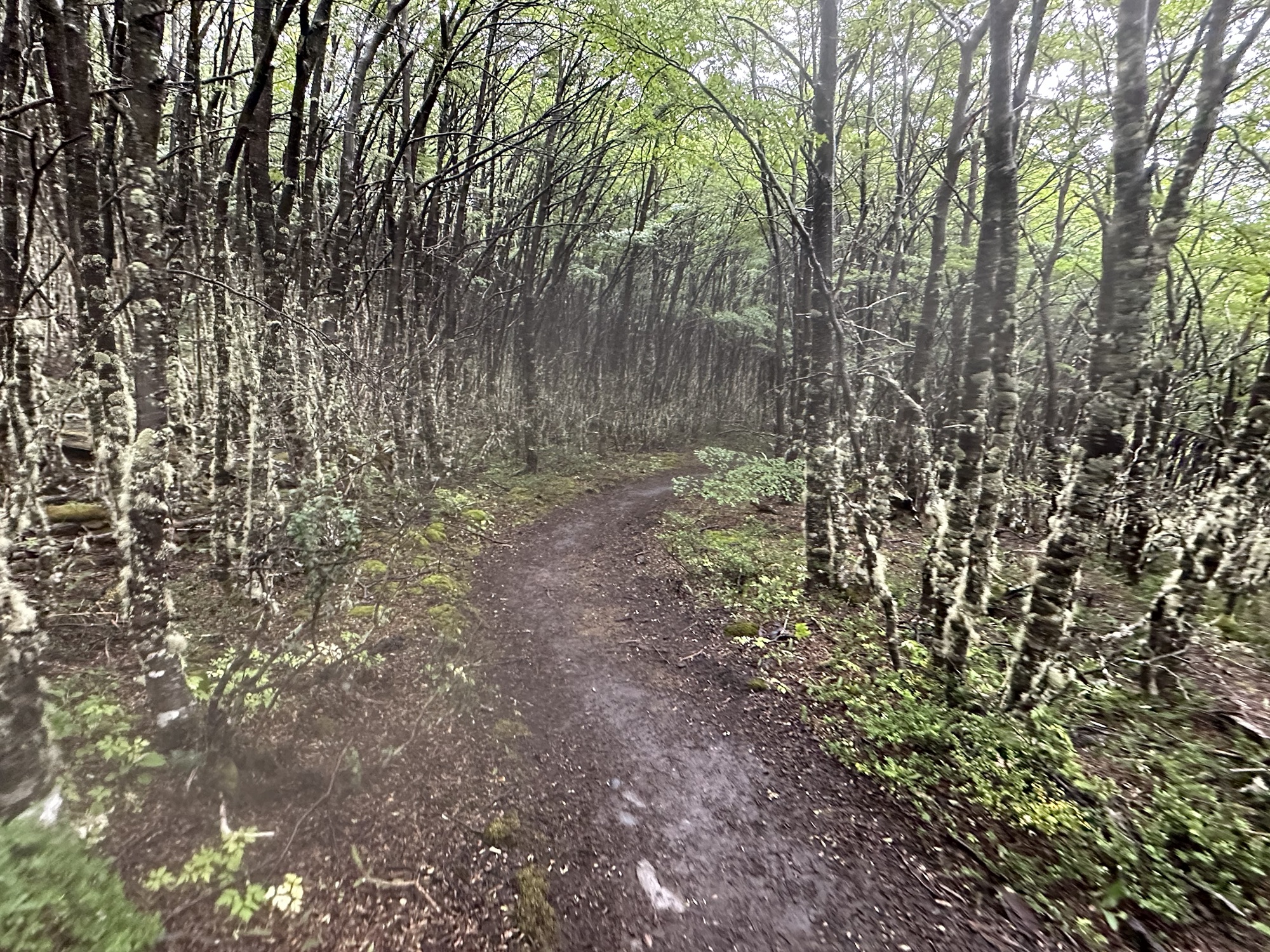
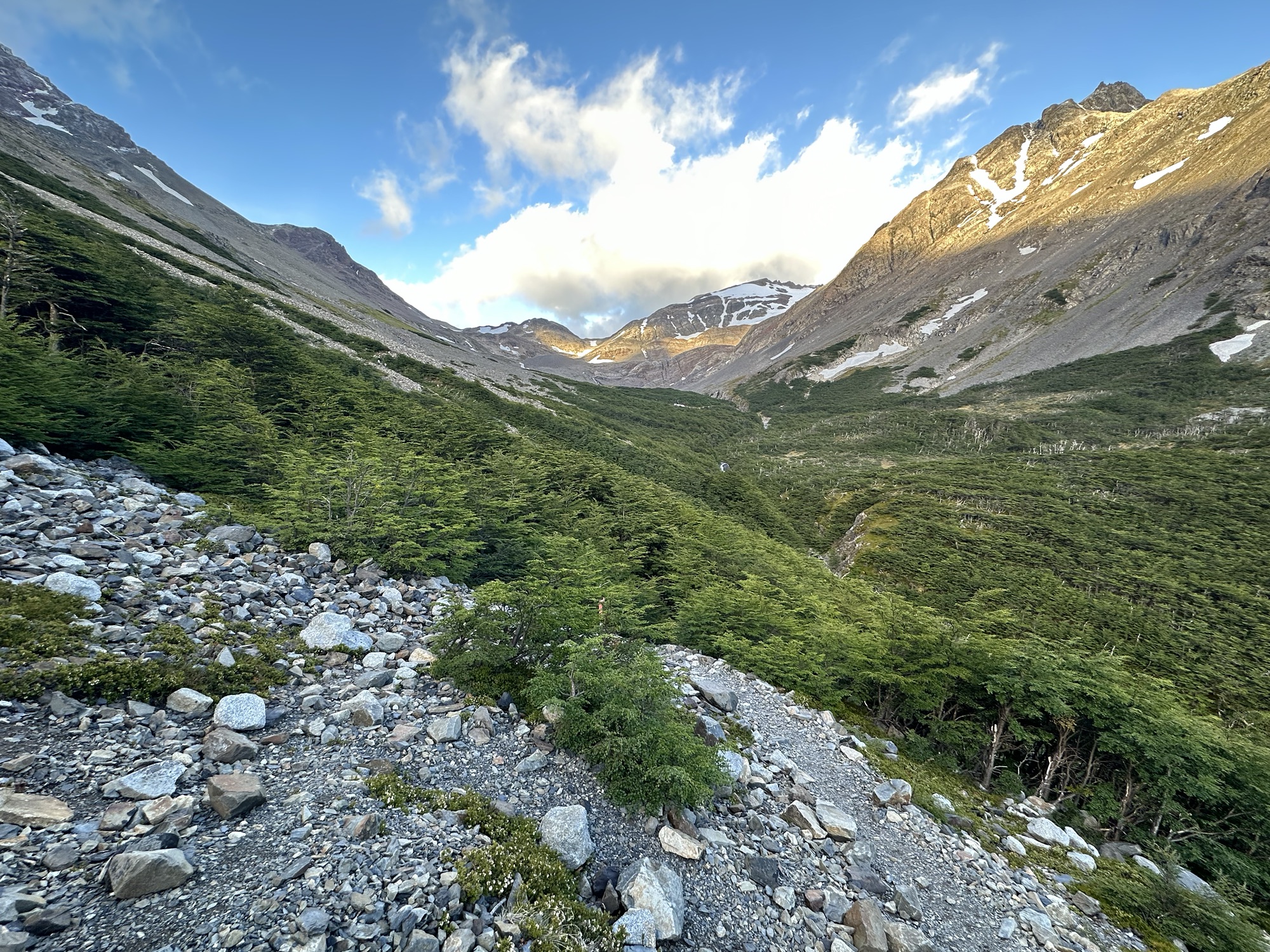
A lot of this day was through the forest
I really enjoyed these trees
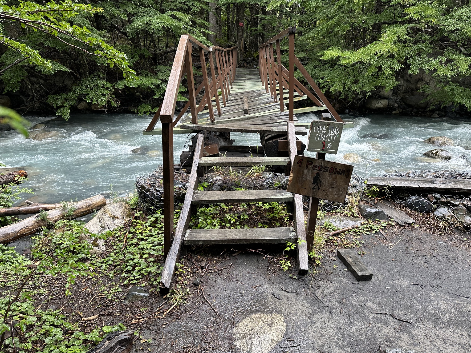
And the award for shittiest bridge on the O Circuit goes to…
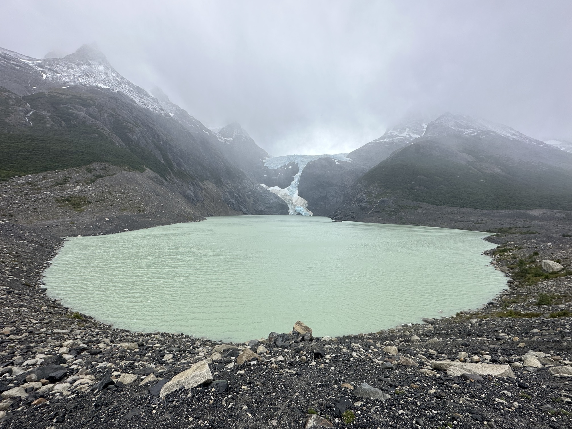
On the other side of this lake you can see some of Glaciar Los Perros
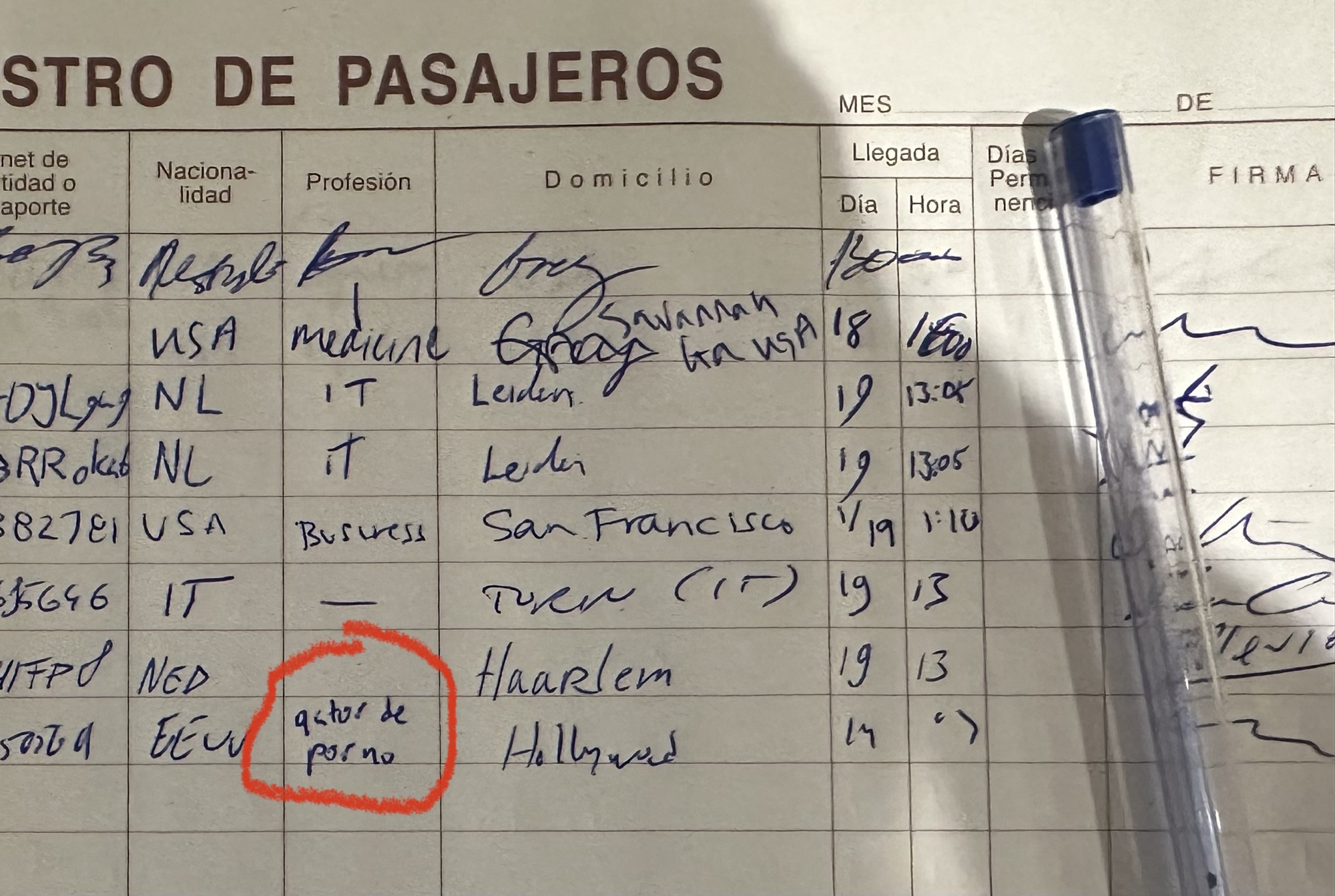
I wrote myself as having a different job in a lot of these books we had to put our info into. Here I told ‘em that I’m a porno actor
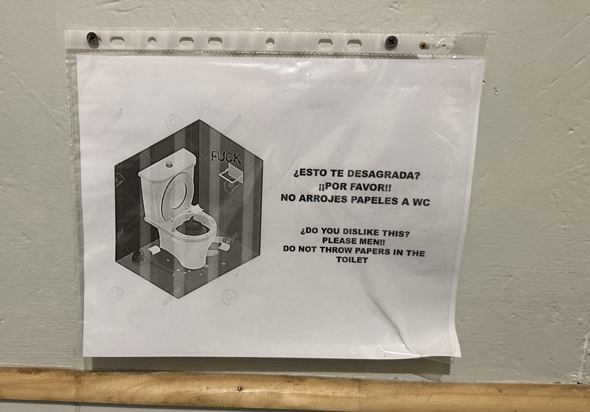
Los Perros was easily the worst and most disgusting camp on the O Circuit. Nobody showers there because they only have cold water and the men’s bathroom had only two toilets, both of which had one of these signs above it. I can’t be 100% sure if these toilets stopped working because someone had thrown paper in it as the signs warned against or just because they’re old and the plumbing sucks, but neither of them worked and it was practically impossible to take a shit in ‘em without everyone else’s piss and shit that’d been piled up in there splashing back up onto you. So god damn disgusting. I’d take squatting in a pit latrine over this any day.
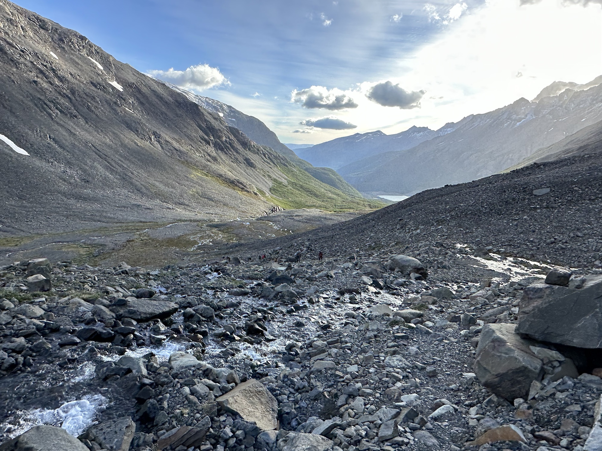
Day 4: Los Perros to Grey
Only 15 kilometers today, but lots of elevation change as we go up and over John Gardner Pass
To get up to John Gardner Pass from Los Perros, we first had to traverse all this forest. Then it was all rocky and bare towards the top with a lot of wind blowing right in our faces
Looking back down on the valley I’d come up and out of. If you zoom in on the middle of the photo, you’ll see a bunch of the other hikers making their way up to the pass behind me
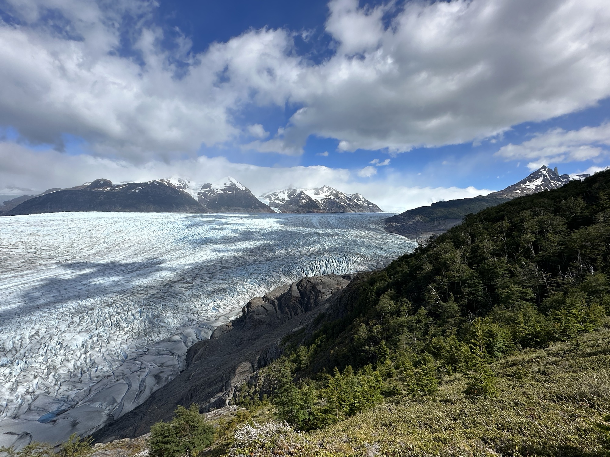
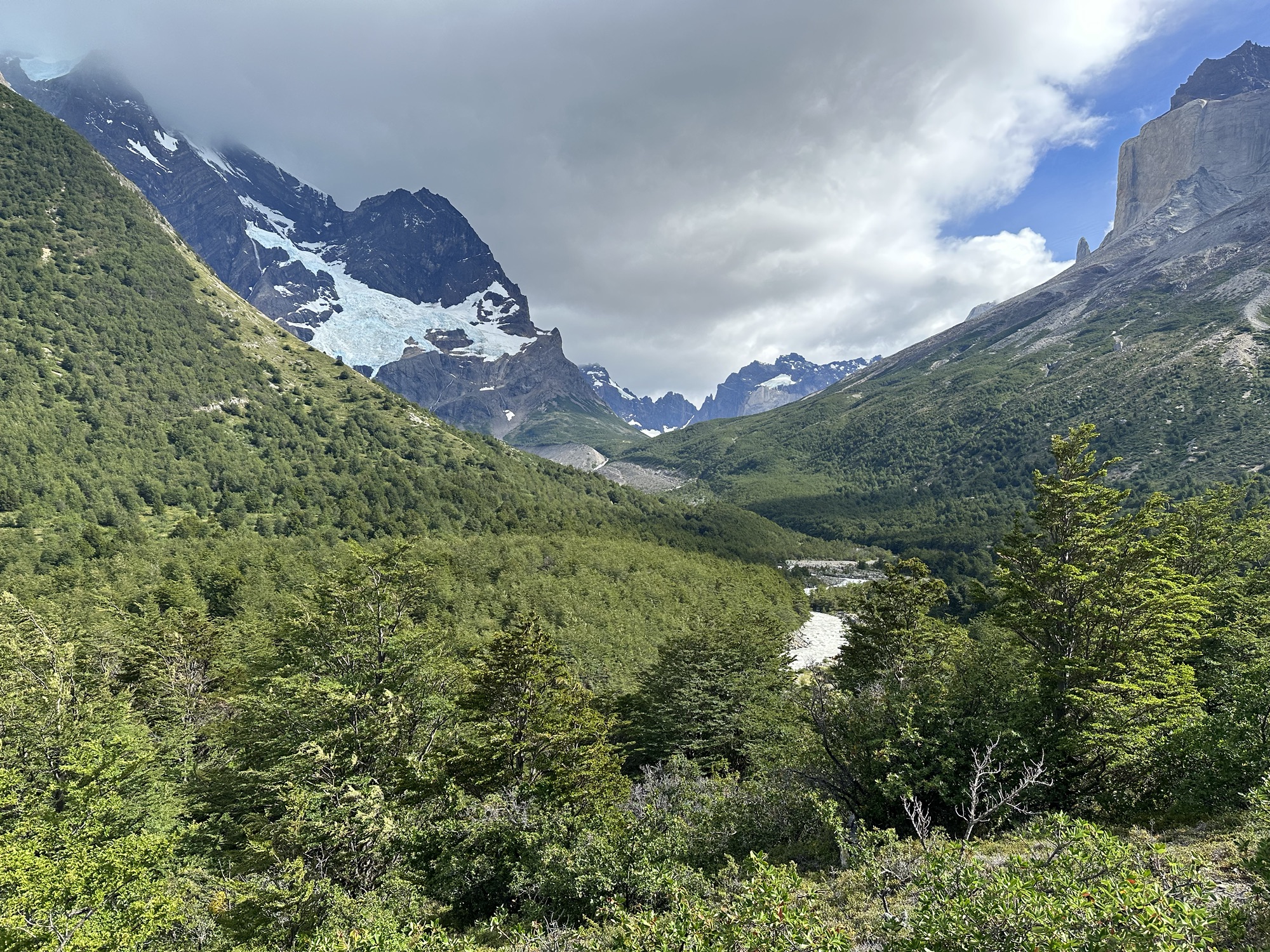
This is what’d been awaiting us on the other side of John Gardner Pass – incredible views of the sprawling Southern Patagonian Ice Field
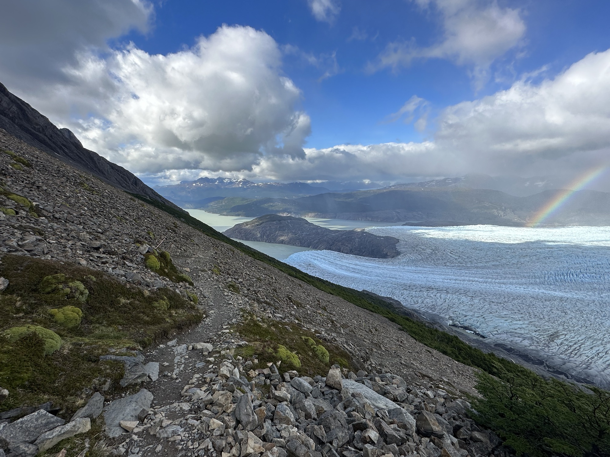
And the glacier had a freakin rainbow comin out of it. This was probably the most spectacular part of the whole trek
Descending
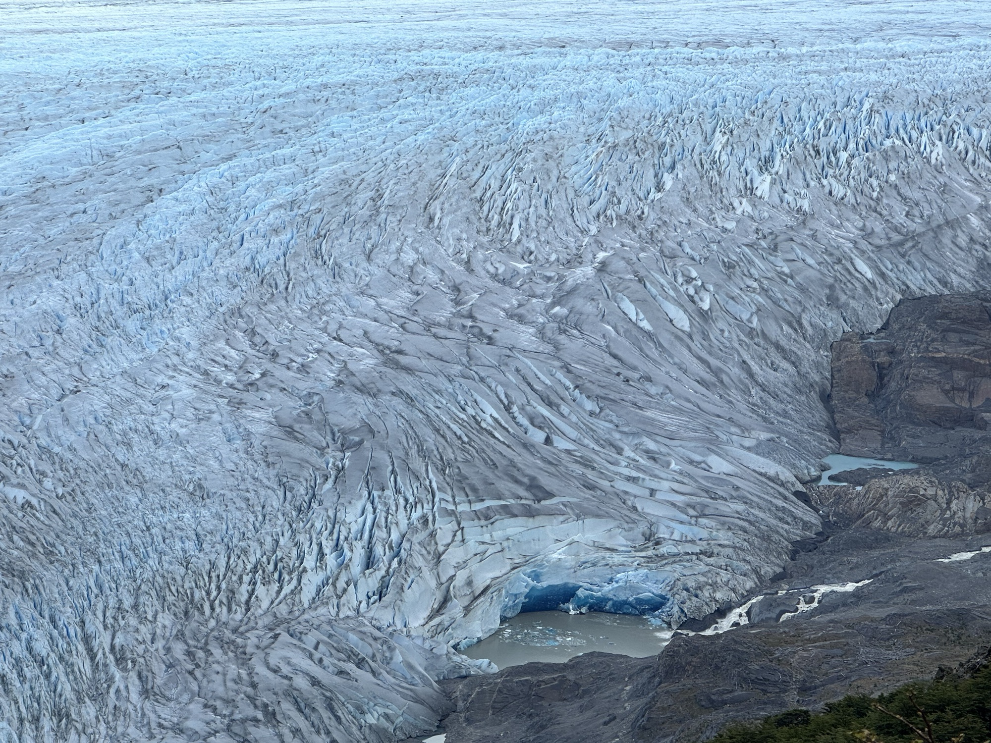
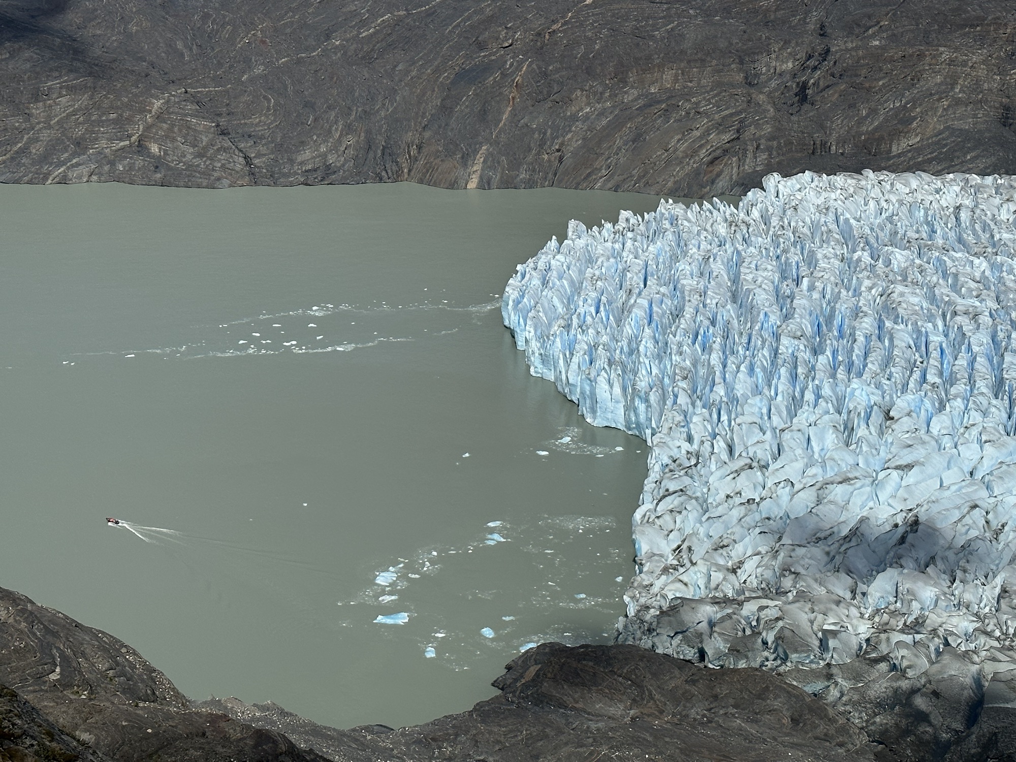
A slightly closer view of where Grey Glacier meets the mountain. Look at all those crevasses
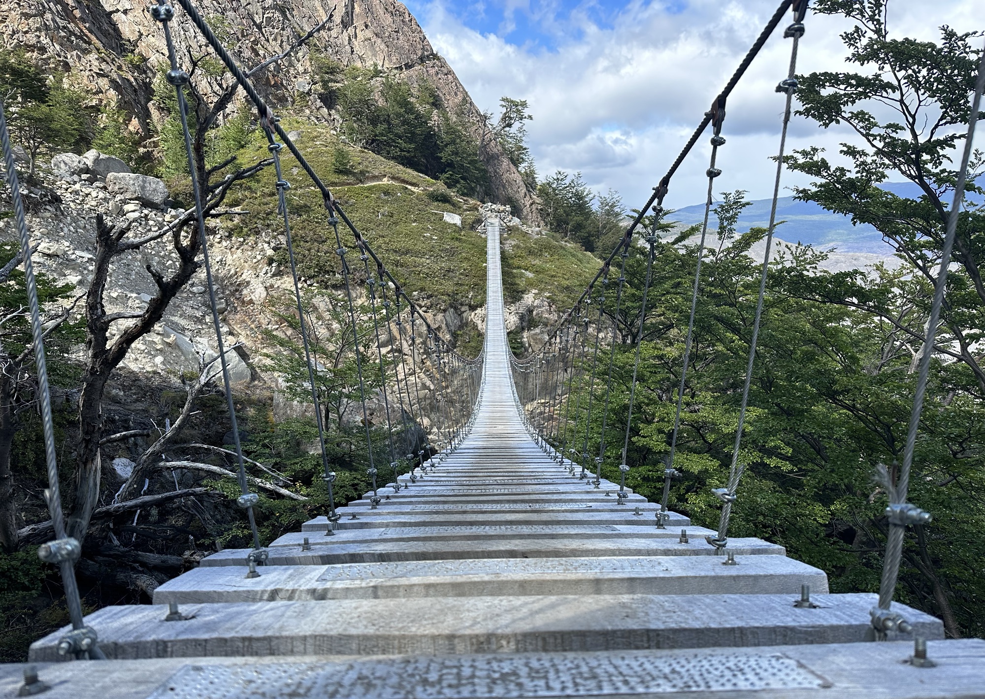
“Mola Ram! Prepare to meet Kali…in HELL!” I don’t know why they made these steps out of wood which will inevitably rot and crack out there in the harsh Patagonian elements. I’m just glad I didn’t have to cross this bridge on one of the dangerously windy days.
Where the glacier meets the water. To give you an idea just how enormous all that ice really is, near the bottom left of the photo is a zodiac boat with like ten people on it driving away from the glacier
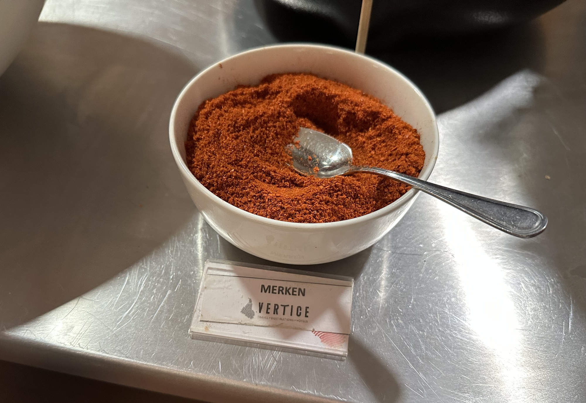
Merkén is a very popular Chilean seasoning made of smoked chili pepper, not to be confused with “merkin” which of course is an English word meaning “pubic wig”
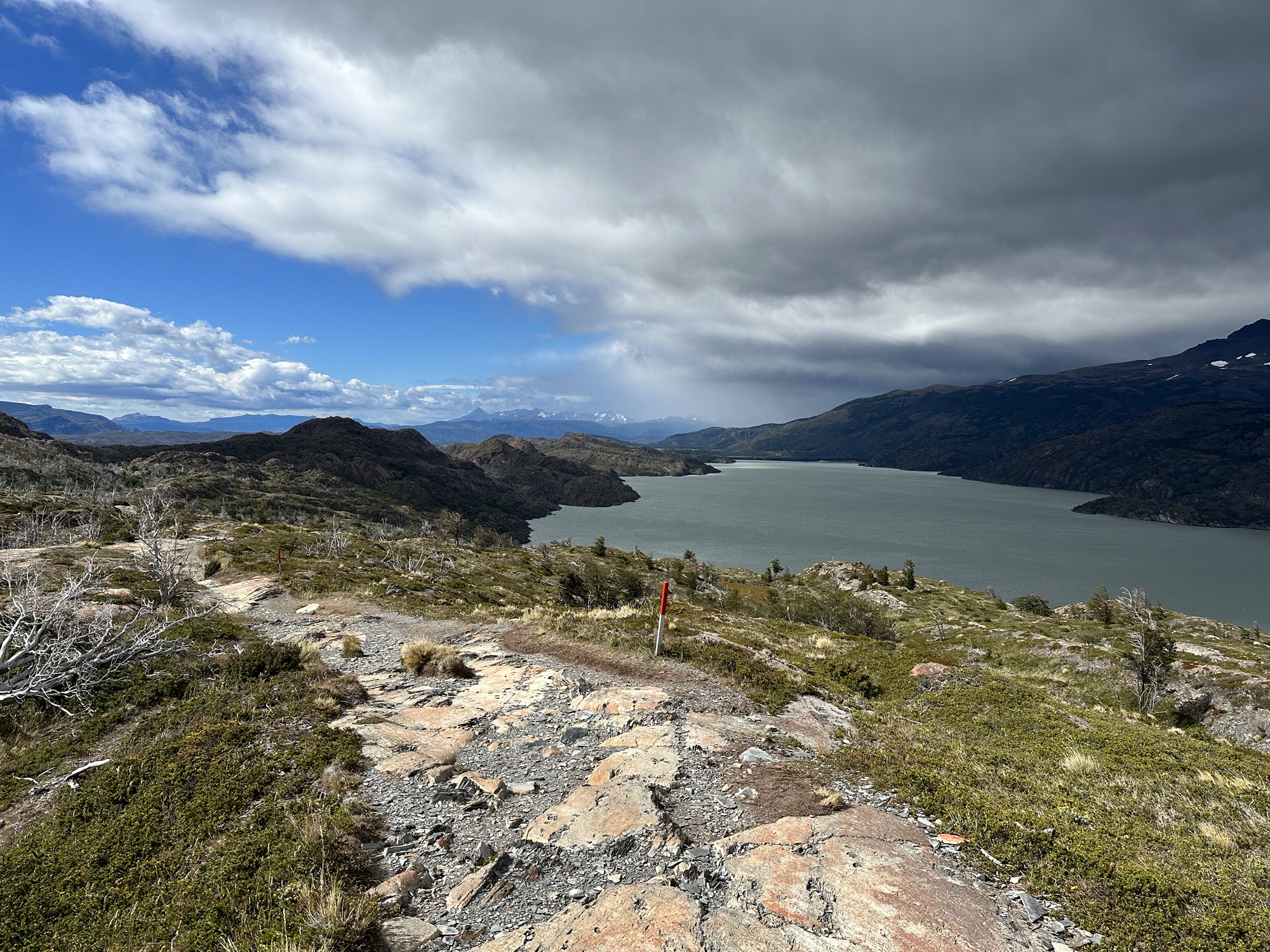
Day 5: Grey to Paine Grande
Another easy day. Only 11 kilometers
The first part of the day was spent walking along Lago Grey
It was a pretty nice day
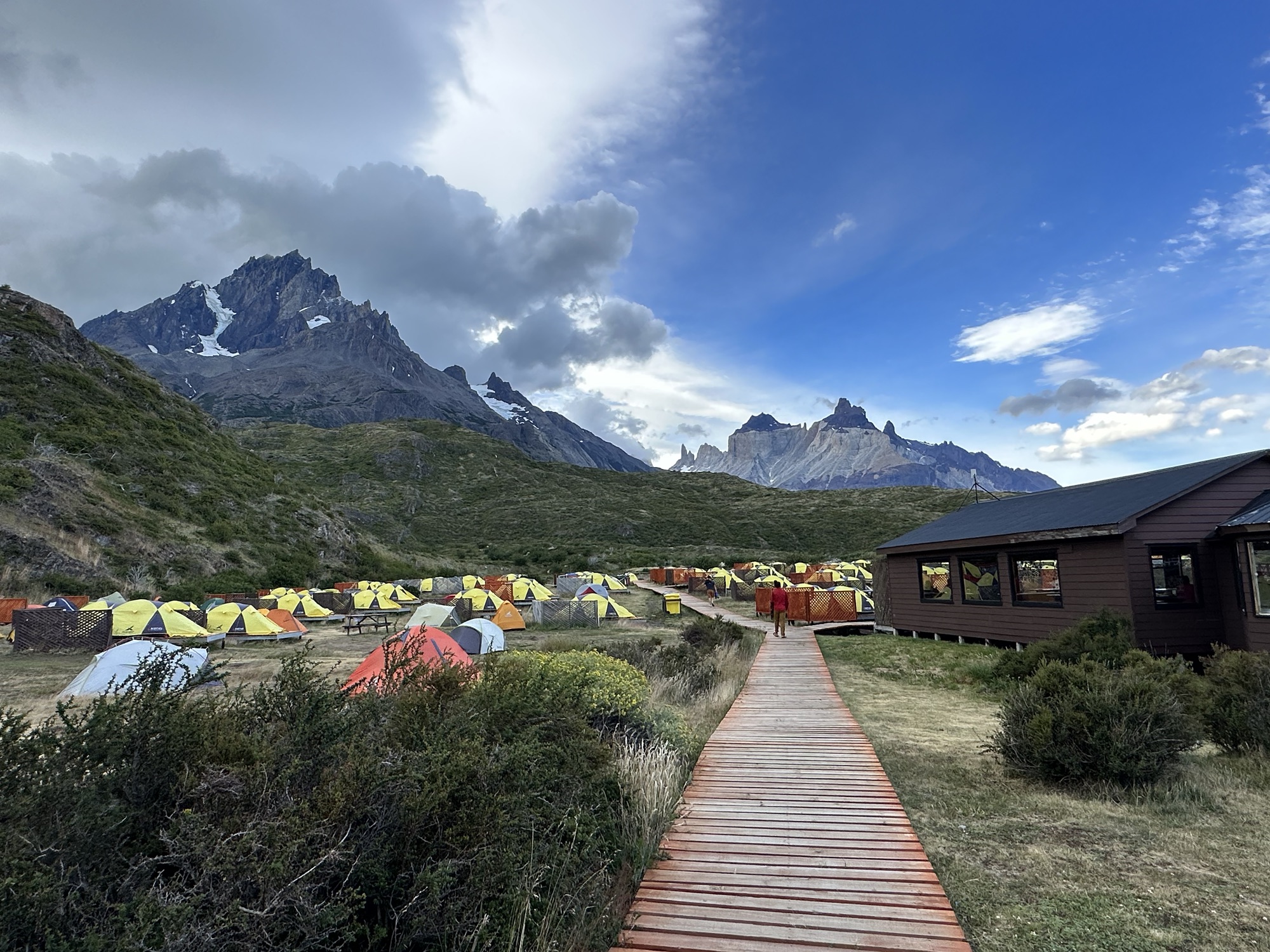
Camp Paine Grande. When a lot of people had been saying it, they said it like “pene grande,” which would make the name of the place “Camp Big Penis”
Day 6: Paine Grande to Francés
Kind of a long day. 20.5 kilometers with a lot of elevation change when climbing up into Valle Francés to visit Mirador Británico and then coming back down
What the view looked like while walking out of Camp Paine Grande
View of Glaciar Francés on the left just before beginning the long climb up to Mirador Británico
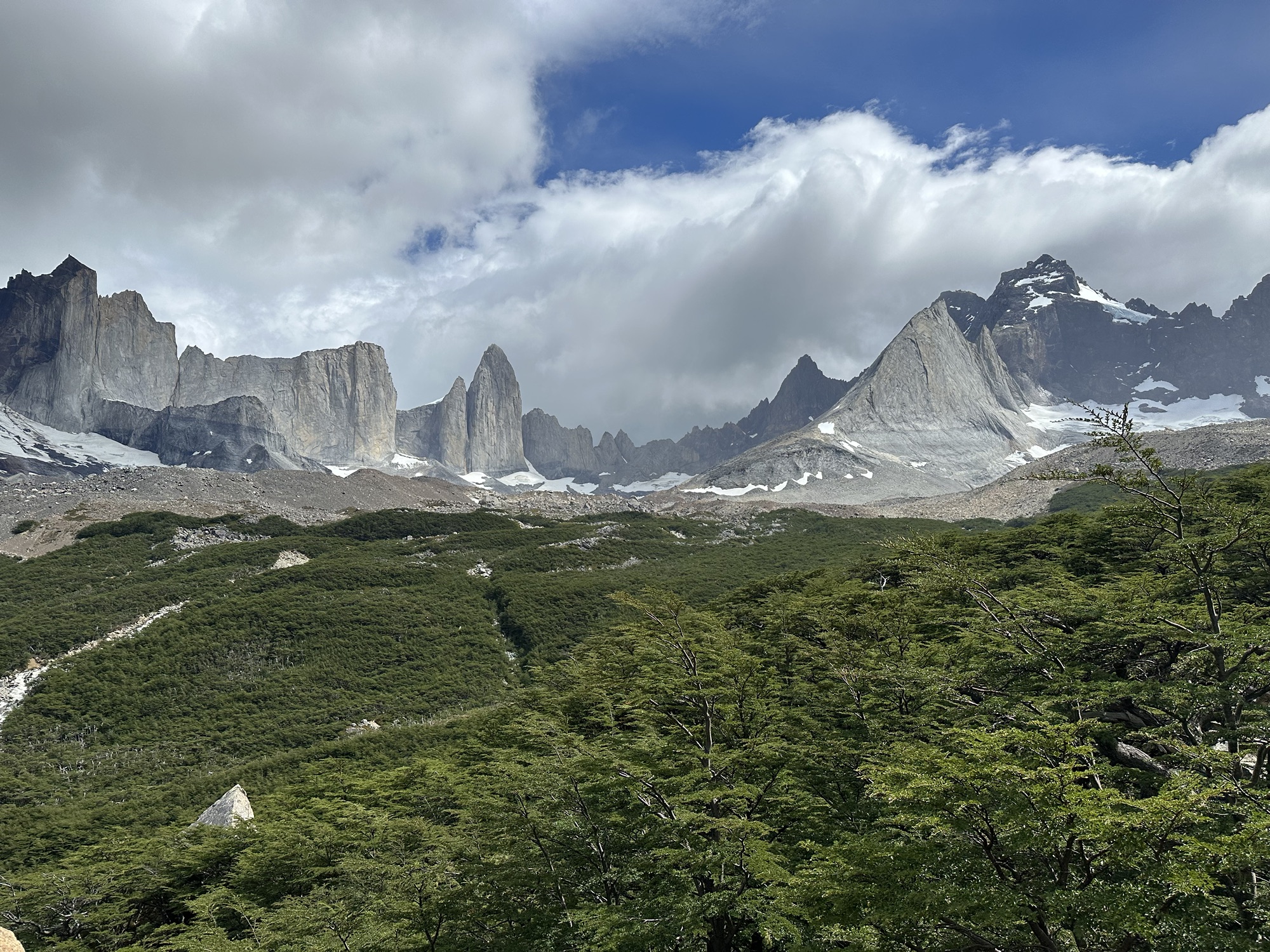
Mirador Británico
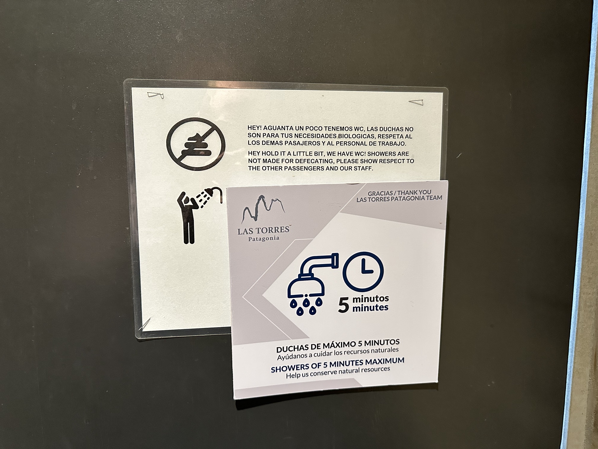
Sign in all the male showers at Camp Francés. If you have to put up a sign reminding people to not poop in the showers, that means it’s happened…possibly more than once.
Beef on top of mashed potatoes at Camp Francés
Day 7: Francés to Central
The majority of this day’s 14km walk was spent alongside Lake Nordenskjöld
This was the windiest day out on the hike. For a few hours, there were pretty constant 60mph winds with even stronger gusts. A few people that I talked to at camp that night said that the wind straight-up blew ‘em over while they were walking and they had the scrapes on their hands to prove it. This looked so much cooler in person (and even on video) than as a still shot, but here’s a waterspout trying to form on Lake Nordenskjöld. And in some of these water twisters I saw forming that day, there were rainbows visible. Rainbows are everywhere in Patagonia
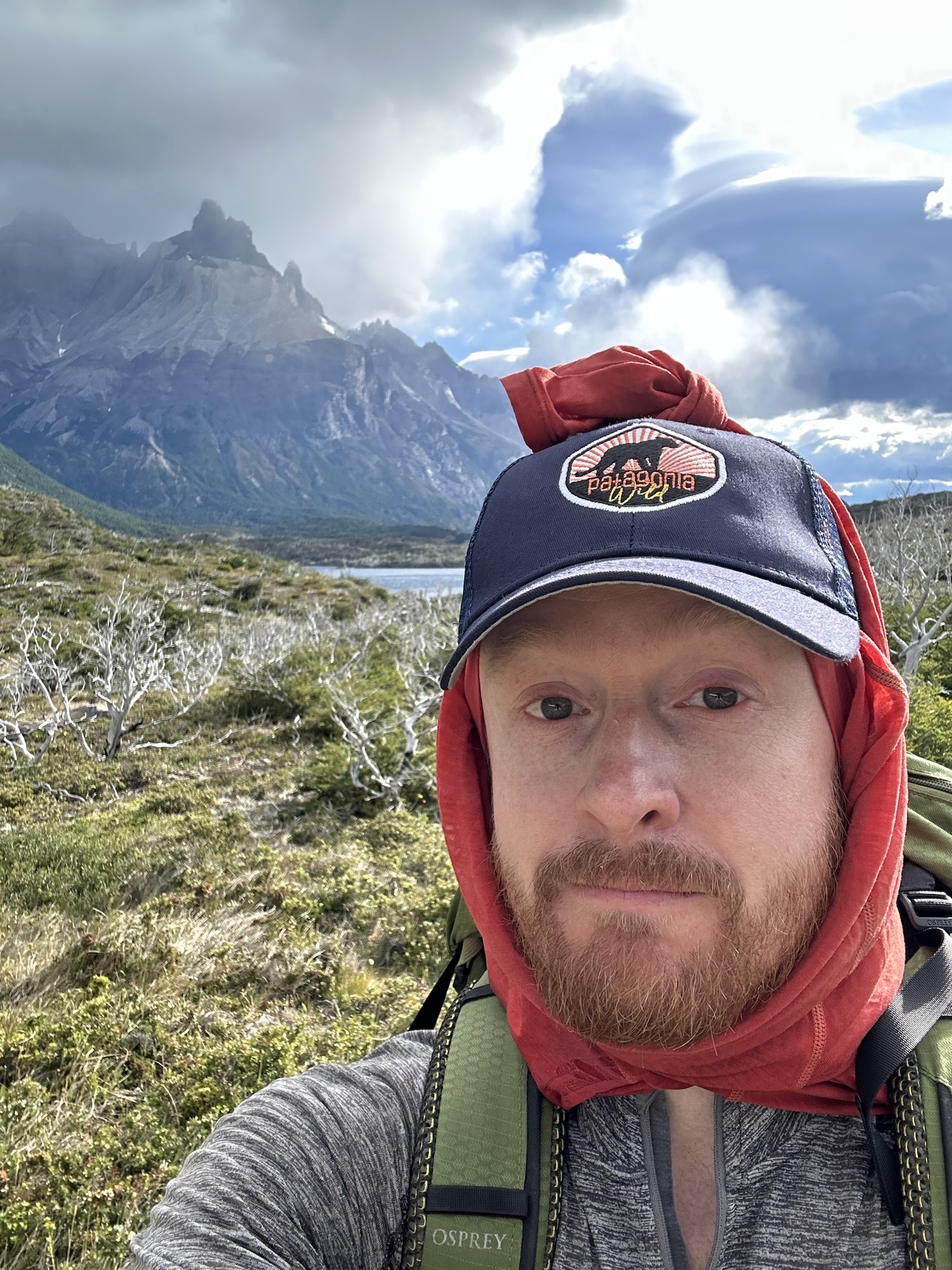
As a way to protect my neck and the sides of my face from getting burnt while hiking, I often drape a shirt down from underneath a baseball cap. I wear the neck hole at the top of my head, have the sleeves straight down covering my ears and have the torso part of the shirt hanging down my back and covering my neck. On a few of the windier days during the hike – and especially this day – I took the sleeves of my “head shirt,” wrapped them up down under my chin then over the top of my head and tied them in a knot so my hat wouldn’t blow away. For the most part it worked really good. The system, however, did fail me on one instance when I was approaching the top of a hill. Out of nowhere, a massive wind gust came up from behind and it was so strong I thought it might knock me off the path and down the side of the hill. So I got low and crawled over behind a nearby boulder where I planned on waiting for that particular gust to die out. As I was in that position, in spite of it being tied down by those sleeves, the wind ripped the hat off my head. I looked up to see where it had gone and in the blink of an eye it was already over the top of the hill and out of sight. I figured I’d never see it again, which was kind of annoying because it was really sunny out and I wanted to keep all that sun off of my face. Anyway, that gust eventually let up and I kept on goin where I was goin. Ten, fifteen minutes later – after I’d gone over that hill and had been making my way down to the bottom of the other side, I saw my hat sitting neatly on top of a bush just off the side of the trail. I ran up and grabbed it before it had the chance to go flying away again. I placed it back upon my noggin and tied it uncomfortably tight this time. It managed to stay put for the rest of that day’s hike.
Finally past Lake Nordenskjöld
Back near the Central campsite and the Welcome Center where I’d started the O Circuit a week beforehand
Day 8: Central to Mirador Base Torres
The objective of Day 8 was to walk from the Central campsite up to Mirador Base Torres then come back down and catch a bus back to Puerto Natales where I had an Airbnb reserved for that evening. The official distance for this hike is 19.5 kilometers with a lot of elevation change
The towers peeking their heads up in the distance as seen early in the morning from Campamento Central
View from El Paso de los Vientos, or Windy Pass, on the way up to Mirador Base Torres. The path runs along the mountain on the left side of the valley just above all that green stuff. If you look straight ahead, you’ll see that there will be a lot more forest to walk through after having gone through this valley.
Passing through the aforementioned forest. Can you see the hiker in the middle of the photo on the trail up there ahead of me?
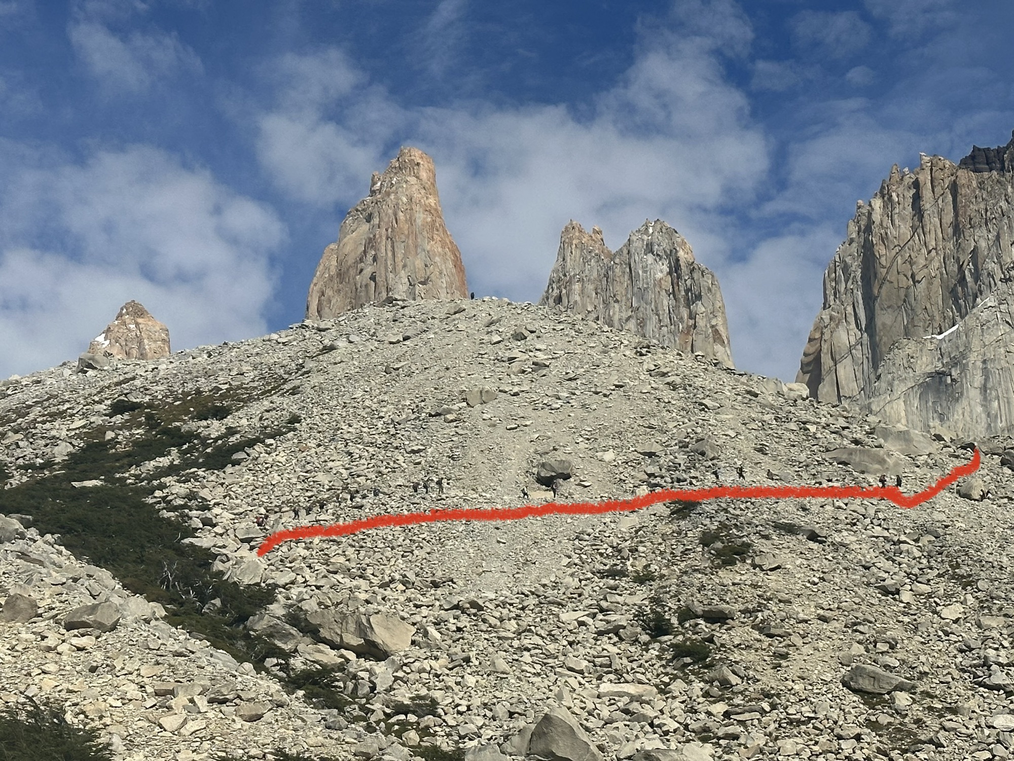
Since it’d be very hard to describe, I decided to trace the path that leads up to the Torres on this final stretch up to the top. Just above the line I drew, if you look very closely, are about a dozen hikers doing what hikers do best
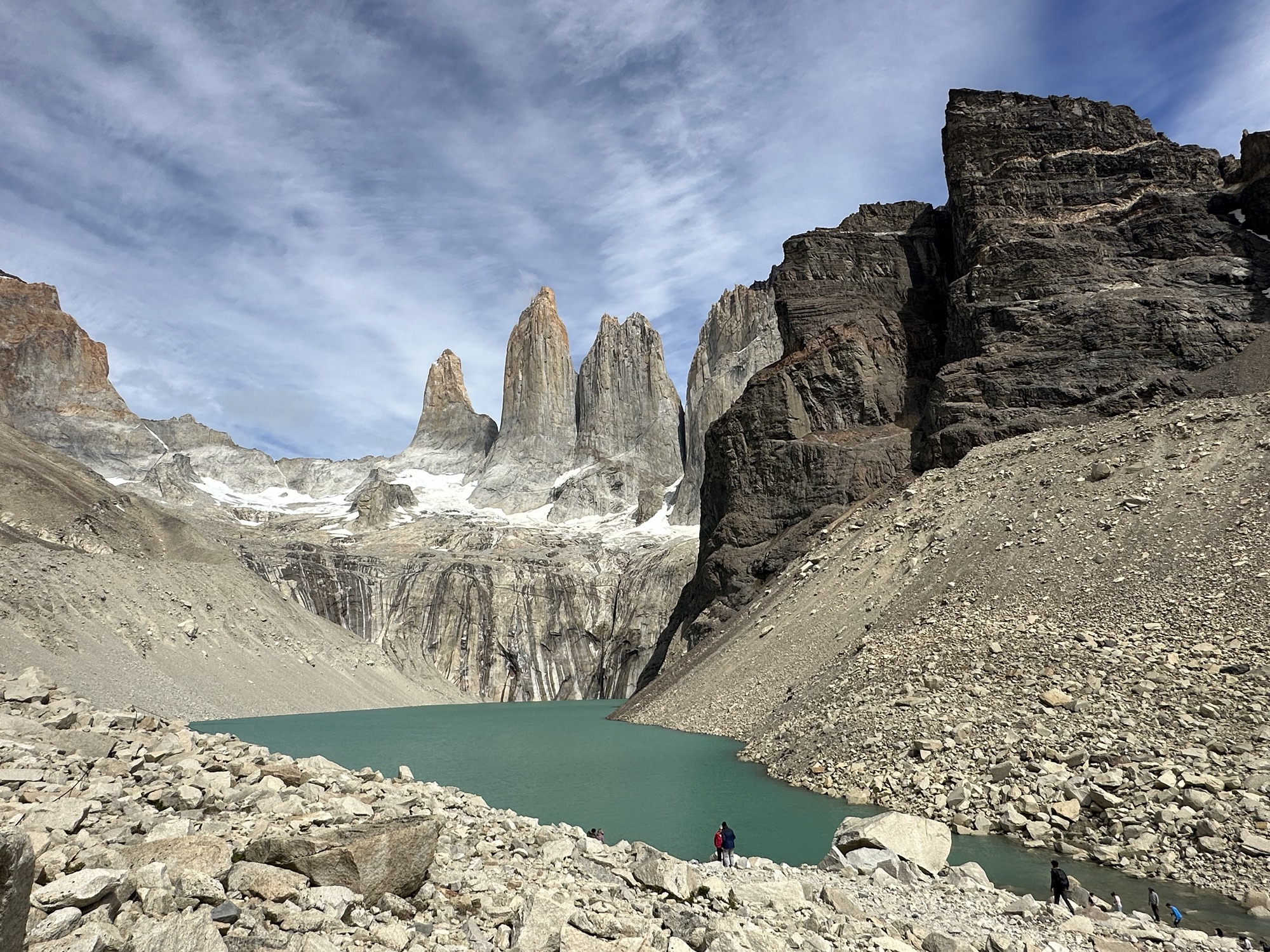
Glacial lagoon with the famous “Towers of Paine” looking down on it. Beautiful day to be up there. Ended up just sitting there taking it all in for like 45 minutes before beginning the long hike back down
Amazing sky back in Puerto Natales around 10pm that evening